Reading Prairie Cover Transitions for South Dakota Pheasants
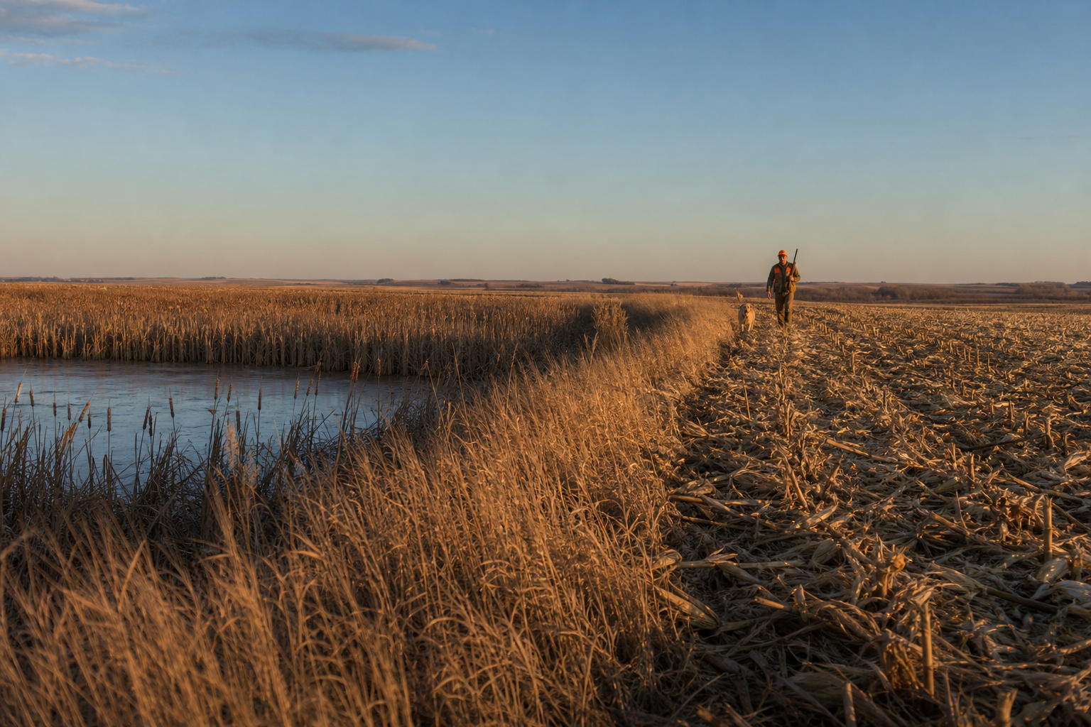
When novice hunters look at a sprawling 320-acre parcel of South Dakota prairie, they often see a uniform sea of tall grass, crop residue, and woody cover. To an experienced guide in the James River lowlands, however, that same field is a complex tapestry of micro-habitats, soil moisture shifts, and distinct vegetative edges that concentrate wild roosters into tight, predictable pockets. Mastering the art of reading prairie cover transitions—the precise lines where native switchgrass meets smooth brome, where cattail sloughs taper into cut corn stubble, or where shelterbelts intercept windblown weed lines—is what separates long, birdless walks from steady flushes and full game bags.
The Geography of the James River Lowlands and the Coteau Edge
To understand cover transitions, you must first understand the ground beneath your boots. Here in Spink County, near Conde, South Dakota, our hunting grounds sit in the fertile lowlands of the James River basin, resting directly below the sweeping rise of the Coteau des Prairies. This unique landscape features subtle elevation shifts of only a few feet across hundreds of acres, but those tiny topographic changes create dramatic variations in soil moisture, plant species density, and bird usage.
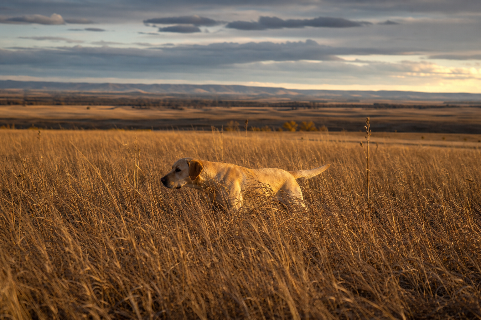
Where the higher, drier prairie benches dip toward low-lying drainages, grass species shift rapidly from upland cool-season grasses like smooth brome to tall native warm-season species like big bluestem, indiangrass, and switchgrass. Where the water table meets the surface, cattails (*Typha latifolia*) and sedges dominate. Wild ring-necked pheasants are edge-dwelling creatures by nature. They rarely spend their lives in the middle of a homogenous monoculture; instead, they navigate the seams where these distinct cover types abut one another. During a day of South Dakota pheasant hunting, learning to identify these elevation and vegetative boundary lines tells you exactly where to put your dogs.
The Science of Edge Effect in Upland Bird Behavior
In wildlife biology, the boundary where two distinct ecological communities meet is known as an "ecotone." Ecotones produce what biologists call the "edge effect"—an increase in wildlife population density and diversity along habitat boundaries. For the ring-necked pheasant, edges provide immediate access to three essential survival needs simultaneously: food, predator escape cover, and thermal protection.
A rooster feeding in a cut cornfield feels inherently vulnerable to avian predators like red-tailed hawks and Northern harriers. If that cornfield lies directly adjacent to a dense swath of Conservation Reserve Program (CRP) grass or a cattail slough, the bird can step six feet out of the crop and instantly vanish into impenetrable stem cover. Conversely, a bird loafing in dense grass needs quick access to grit and waste grain without having to run through hundreds of yards of thick vegetation that hampers its quick escape footwork.
### Soft Edges vs. Hard Edges
Not all edges are created equal, and understanding the difference between hard and soft edges changes how you hunt a field:
* Hard Edges: A distinct, sudden line separating two vastly different habitat types—such as a sharp fence line dividing a manicured dirt road or plowed black dirt from knee-deep grass, or a clipped standing corn border touching short-mowed ditch alfalfa. Hard edges allow hunters and dogs to move fast, but roosters often treat them with caution during high pressure, choosing to hold back five to ten yards inside the heavier cover. * Soft Edges: Gradual, feathering transitions where plant species intermingle over a span of ten to thirty feet. Examples include a weed-choked ditch where kochia, sunflowers, and foxtail bleed slowly into a switchgrass stand, or a slough perimeter where giant ragweed tapers into canary grass. Soft edges are pure magic for wild roosters. They offer structural complexity, abundant weed seeds, broadleaf canopy protection, and ideal concealment from both overhead and ground-level threats.
### The 15-Foot Transition Zone
If you were to track pheasant foot traffic with high-resolution GPS collars across a typical South Dakota farm, you would find that a disproportionate amount of a bird’s daylight hours are spent within a 15-foot ribbon running along cover transitions. When walking large CRP fields or expansive river bottom pastures, walking straight down the middle of a uniform grass stand is often a low-percentage strategy. Routing your walk so that your hunters and dogs consistently sweep along that 15-foot transition ribbon will yield double or triple the bird encounters over the course of a afternoon.
Morning Transitions: Roosting Grass to Feeding Seams
As daylight breaks over the prairie, wild pheasants undergo their first major daily movement. Pheasants roost on the ground overnight in light to medium-density cover—typically roosting grasses that offer overhead protection without being so thick at ground level that it prevents them from waking up and running if an owl or coyote approaches.
When the sun begins to warm the tops of the vegetation, birds move out of their roosting cover toward feeding areas. However, early morning dew creates a critical factor that many visiting hunters overlook. Heavy dew on tall switchgrass or brome soaks a bird’s feathers, making flight difficult and draining vital body heat. To dry off, roosters seek out open, sunlit transition lines that catch the early light while remaining within a single burst of flight from safety.
Look for morning roosters along these specific morning transition zones:
* Gravel and Dirt Seams: The narrow, grassy strip between a quiet field road and crop land where birds gather to gather crop grit and dry their flight feathers in the morning sun. * South-Facing Grass Edges: High-stem-density grass edges that face south or southeast, receiving direct morning sunlight while blocking cold north winds. * Low-Density Crop Edges: The first three to five rows of standing corn or milo directly adjacent to roosting grass, where birds can pick waste grain while staying shielded from overhead moisture.
When working these areas shortly after legal shooting hours, keep your hunting line tight to the seam. Let your dogs quarter crosswind through the soft edge where birds are walking out of the damp roosting cover into the open feeding strips.
Midday Micro-Habitat: Dense Structure, Shade, and Windbreaks
By late morning—usually around 10:30 AM to 11:00 AM—pheasants have completed their primary morning feed and filled their crops with grain, weed seeds, and grit. They now transition into loafing and digestion mode. During this portion of the day, birds abandon open crop edges and retreat into dense, high-overhead structural cover that shields them from solar heat on warm days, cold prairie winds on freezing days, and sharp-eyed aerial predators.
This is when guided pheasant hunts shift focus toward heavy micro-habitats within the interior of properties. You are no longer hunting broad feeding edges; you are target-hunting isolated thickets, structural brush, and dense stem-density seams.
### High-Stem Density Brush vs. Open Canopies
Not all brushy cover holds birds during midday. Old shelterbelts with mature, wide-spaced trees often feature an open canopy and an empty, dirt-scoured ground level underneath. Predators like foxes and raccoons easily hunt these bare tree lines, and wild roosters generally avoid them.
Instead, seek out dense brush transitions characterized by tight stem density at ground level:
* Wild Plum Thickets: Low-growing, thorny plum thickets embedded inside high grass form natural strongholds for roosting wild birds. The dense top weave blocks raptors, while the tangled ground stems give roosters running lanes. * Russian Olive and Siberian Elm Sucker Growth: Thick sapling edges surrounding older shelterbelts that drop tight foliage right to the prairie soil. * Snowberry and Buckbrush Patches: Low woody shrubs that line subtle draw bottoms in native grass pastures.
### Windbreaks and Thermal Swales
Midday micro-habitat reading requires analyzing wind and temperature. On days with high South Dakota winds (20+ mph), roosters will drop out of flat prairie grass and concentrate in narrow elevation dips—known as thermal swales or micro-draws. A swale offering just three to four feet of elevation drop creates a calm micro-climate where wind speed at ground level drops significantly. If that swale contains dense broadleaf weeds like kochia or goldenrod, roosters will stack into it by the dozens.
Wetland Margins: Hunting Cattails and Sedge Basins
No cover transition in South Dakota pheasant hunting is more iconic—or more productive—than the line where grassy prairie gives way to cattail sloughs and wetland basins. In the James River lowlands, seasonal wetlands and prairie potholes dot the terrain. These cattail complexes serve as thermal sanctuaries, survival cover during late-season snowstorms, and impenetrable safe havens from heavy hunting pressure.
However, diving straight into the center of a 40-acre cattail slough without a plan is a quick way to wear out hunters and let roosters double back behind you. The secret lies in hunting the transition margins.
### Navigating Frozen vs. Soft Marsh Edges
Early in the season, when cattail basins retain standing water or soft mud underneath, birds rarely sit in the middle of the marsh. They loaf along the narrow ring of reed canary grass and river bulrush that forms the dry boundary ring between the upland grass and the deep cattails. Walk your line along this dry grass margin, keeping dogs working just inside the first five yards of tall marsh growth.
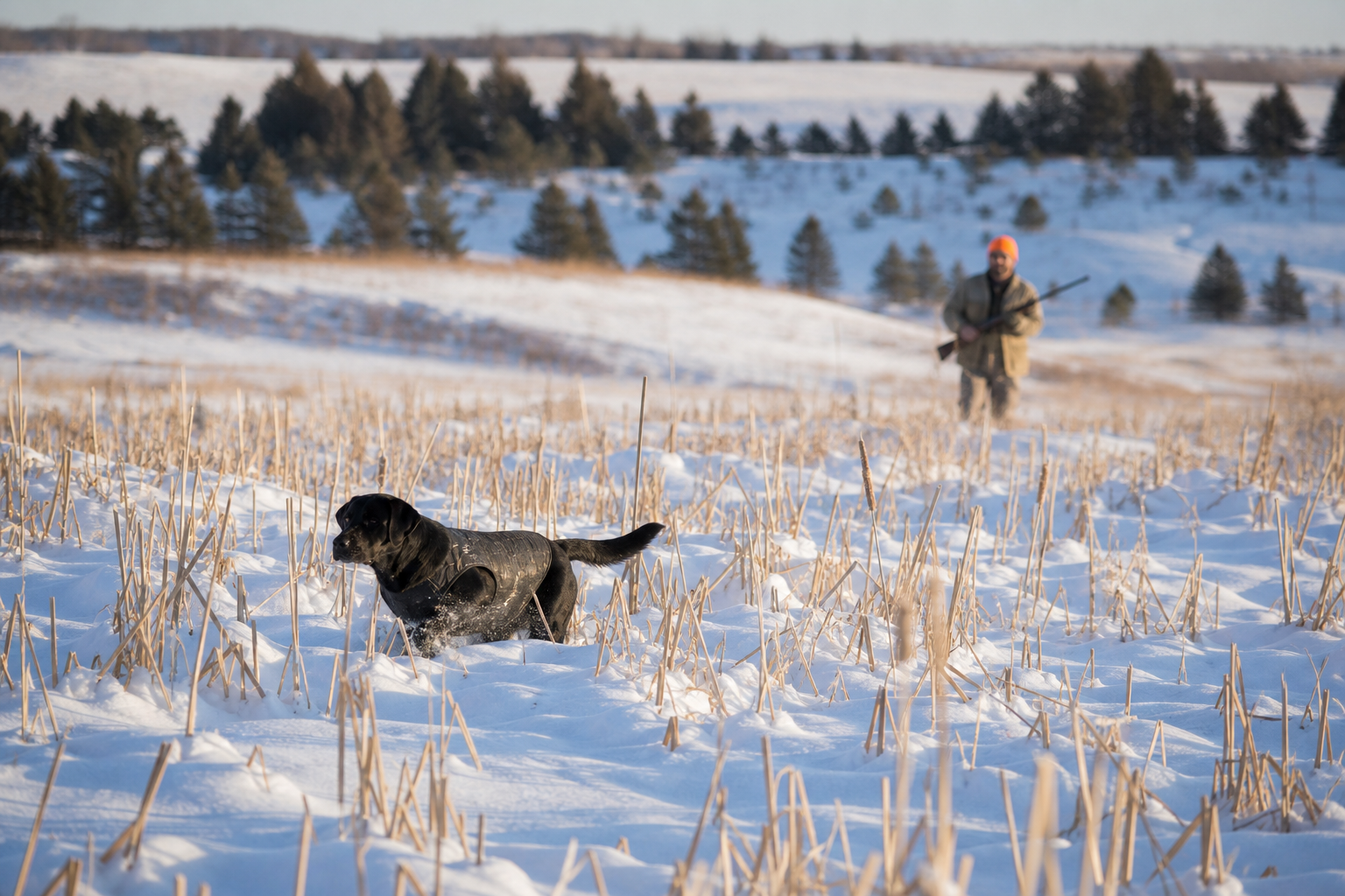
Later in the fall, once hard freezes solidify the slough floors, birds spread out across the interior of the cattails. Even then, roosters use the structural transition lines within the slough itself. Look for inner edges where narrow channels of yellow river bulrush cut through dark, dense cattail beds, or where isolated willow clumps interrupt the uniform cattail canopy.
### Ringing the Slough: Tactical Dog Positioning
When driving or working a wetland margin, positioning your flushing dogs along the outer cover seam is critical. A flush dog that plunges deep into the center of a thick cattail marsh will often push roosters down internal foot paths toward the edges. If your hunters are positioned along the grassy perimeter transition, those roosters will burst out into clear view over the low upland grass, providing clean, open shots.
Weather-Driven Shifts: Wind, Barometer, and Solar Exposure
Micro-habitat reading is dynamic; the exact cover transition that holds fifty birds on Tuesday morning might be completely empty by Wednesday afternoon if a atmospheric cold front rolls off the Coteau. Understanding how weather shifts alter bird choices across cover seams allows guides to adjust tactics on the fly.
| Weather Condition | Bird Position relative to Cover Transitions | Tactical Adjustment | | :--- | :--- | :--- | | High Wind (20+ mph) | Leeward (downwind) side of dense woody shelterbelts, deep swales, and thick cattail edges | Work crosswind along downwind shelter seams; keep blockers tight to edge exits | | Heavy Rain / Wet Snow | Broadleaf weed patches (kochia/sunflower) and high-stem switchgrass off saturated ground | Avoid low-lying slough floors; hunt elevated grass-to-crop seams where water drains | | Bright Sun & Sub-Zero Cold | South-facing plum thickets, cattail edges, and dark crop-residue seams absorbing heat | Move slowly along south-exposed transition belts; look for birds sunning on edge perimeters | | Overcast & Falling Barometer | Active feeding along high-contrast corn/milo boundaries near heavy winter roost cover | Intercept birds right on the edge of agricultural crop transitions before weather strikes |
Vegetation Key: Indicator Plants That Hold Wild Roosters
An expert guide constantly scans the ground, identifying plant species that signal high-quality cover transitions. When walking a field, train your eyes to look for these key indicator species:
* **Switchgrass (*Panicum virgatum*):** A stiff, upright warm-season native grass that resists heavy snowfall. Look for the seam where soft brome meets rigid switchgrass—birds use the switchgrass for thermal protection and run along the brome seam. * **Kochia (*Kochia scoparia*):** Often called fireweed, this bushy plant forms dense, branched cover along crop edges and disturbed soils. Kochia patches provide outstanding overhead canopy with open running space beneath the leaves. * **Foxtail (*Setaria spp.*):** Green and yellow foxtail along the edges of agricultural fields offer a high-calorie wild seed source. Roosters will spend hours picking through foxtail seams adjacent to standing grain. * **Giant Ragweed (*Ambrosia trifida*):** Thrives in moist transition soils between field corners and sloughs. Its tall, woody stems create a ceiling that shields birds from raptors while allowing them to move quickly on foot underneath. * **Wild Sunflowers (*Helianthus annuus*):** Natural or planted sunflower strips create high-visibility edge corridors. The oily seeds are a favorite pheasant food, and the heavy stalk structure creates natural lane transitions.
Dog Handling Along Habitat Seams with British Labradors
At Coteau View Kennels, our philosophy is simple: *we don't breed for color, we breed for capability*. Our British-line Labrador retrievers are purpose-built for navigating complex prairie cover transitions. British Labs are renowned for their calm, methodical quartering style, exceptional scenting ability, and instinctive desire to stay within gun range without blowing out wild birds.
Hunting cover transitions requires specialized dog handling tactics. Because scent patterns behave differently along habitat edges, handling your dog properly along these seams directly affects your success:
* Understanding Scent Cone Drift Along Edges: Wind traveling across an open field hits a tall wall of cattails or switchgrass and swirls, creating a "scent eddy" right along the transition seam. A dog working directly on the edge line can easily pick up bird scent trapped in this eddy from roosters holding 15 to 20 yards inside the heavier cover. * Managing the Crosswind Sweep: Route your walk so that the prevailing wind blows from the thick cover toward the open transition strip. Command your Lab to quarter across the seam, entering the heavy edge and pulling back out into the light cover. This forces the dog to cross the scent cone at a 90-degree angle, giving them an instant lock on bird movement. * Preventing Edge-Running: Wild roosters love to use clear transition lines as running highways. A hyper-aggressive dog will often smell a running rooster along an edge, get locked into track-scent, and push the bird 100 yards out of range. British Labs excel here because of their close-working nature; they hunt with their nose in the air catching wind-scent, pin the bird against the hard edge constraint, and force a close-range flush.
Tactical Route Planning: Working Edge Seams and Funnels
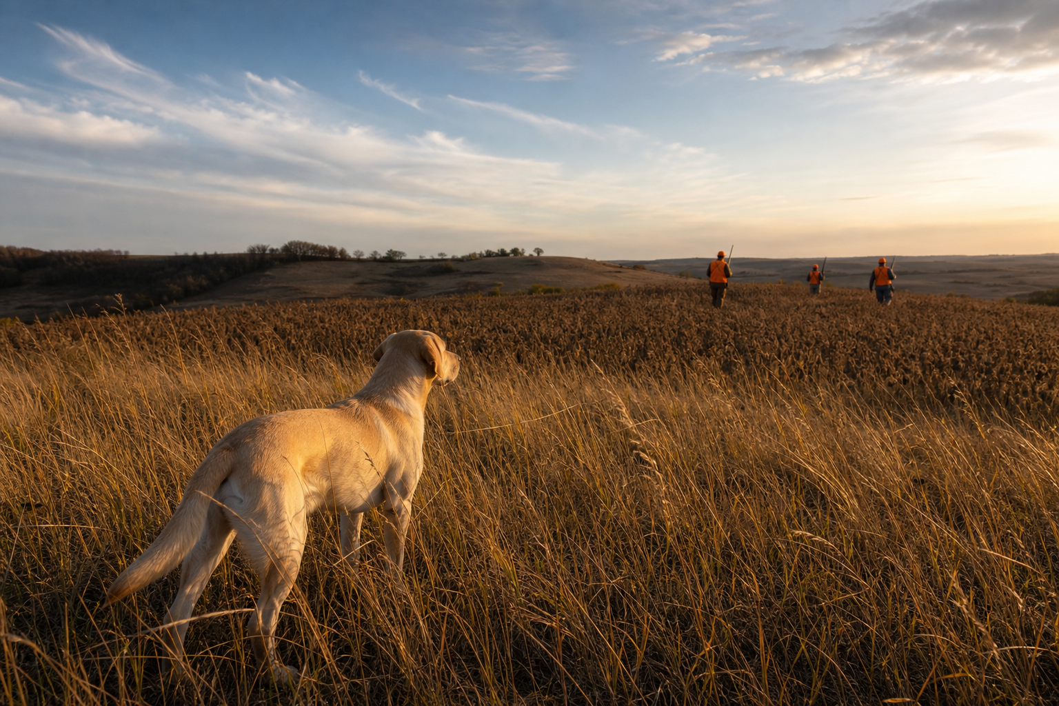
When planning how to push a parcel of land, structure your walk around natural habitat funnels and transition pinches. Instead of walking wide, straight strips across a square pasture, lay out a route that uses cover transitions to guide wild birds toward your blockers.
### The Pincer Sweep along Narrow Belts
When hunting a narrow habitat transition—such as a 30-yard-wide strip of weed cover between a cornfield and a shelterbelt—deploy a pincer movement. Position your walkers in an angled wedge: the inside hunter walks slightly ahead along the heavy brush edge, while the outside hunter walks slightly back along the open crop edge. This prevents birds from squirting sideways out of the transition strip into the open field, forcing them to move forward down the funnel toward designated shotguns.
### Identifying Micro-Funnels
A micro-funnel occurs where two distinct transition lines merge into a single point. Examples include:
* The precise spot where a narrow shelterbelt terminates directly into the corner of a cattail slough. * A narrow grass waterway that cuts through a cut cornfield and connects two larger CRP parcels. * A wedge where a fence line weed corridor intersects an agricultural crop corner.
These micro-funnels are natural convergence zones. As hunters push cover toward these points, roosters running ahead of the dogs reach a decision boundary where cover thins or changes direction. Rather than stepping into bare dirt or open short grass, the roosters will freeze, hold tight, and flush in a tight cluster right at the pinch point.
Book Your South Dakota Pheasant Hunt at Coteau View Hunts
Understanding prairie cover transitions, habitat edges, and micro-climates is second nature to our guides at Coteau View Hunts. Located near Conde, South Dakota, in the heart of Spink County's legendary James River lowlands, our family-run pheasant hunting lodge offers world-class, fully guided wild and preserve pheasant hunts across premier private habitat meticulously managed for upland birds.
When you hunt with us, you enjoy all-inclusive private lodging featuring a spacious great room, home-cooked prairie meals, a 4-acre stocked fishing pond for midday recreation, and the opportunity to shoot over elite, highly trained dogs from Coteau View Kennels. Whether you are organizing a corporate group, a family retreat, or a trip with lifelong hunting partners, we provide an unforgettable South Dakota upland experience.
Ready to experience South Dakota pheasant hunting at its finest?
* Phone: 605.395.7788 * Email: info@coteauviewhunts.com * Website: [Coteau View Hunts](https://www.coteauviewhunts.com)
Contact us today to check dates, discuss custom group packages, and reserve your spot in the field for the upcoming South Dakota pheasant season.
Ready to hunt this country?
We guide wild-bird pheasant hunts on private South Dakota ground. Check open dates or call the lodge at 605.395.7788.